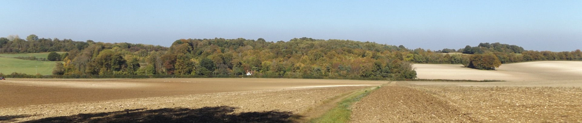
High Elms and Downe
Distance: 3.8 Miles (1h 40 m)
OS Map: Explorer 147 (Start at grid
reference TQ440625 )
Click map to enlarge and click
again to enlarge further
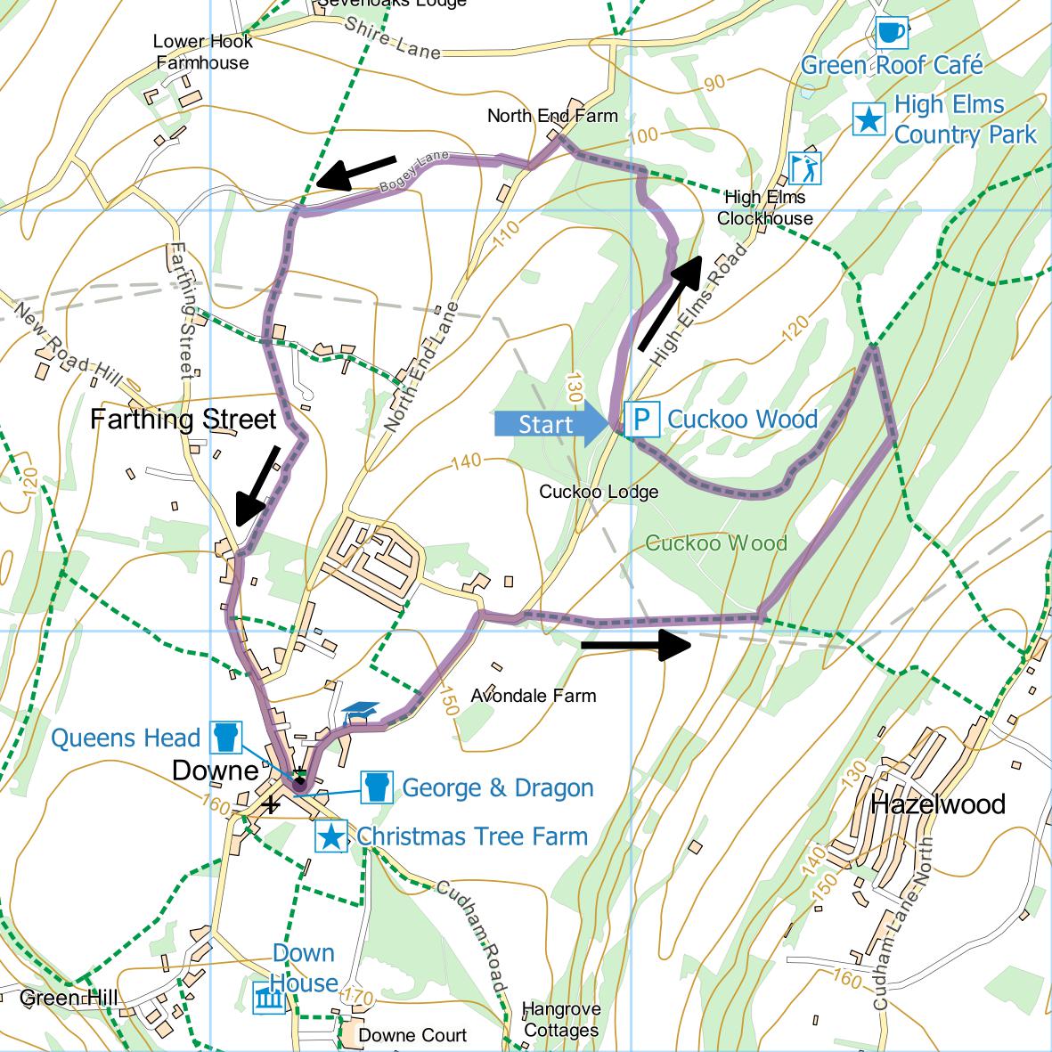
Park in the Cuckoo Wood car park – if approaching
from Shire Lane, this is along High Elms Road on the
left half a mile beyond the golf club house.
Leave car park by entrance and take path immediately
opposite. Cross bridle path, go through kissing
gate and follow footpath across meadow, a carpet of
cowslips in spring, towards woodland. Leave by
gate at far left and keep close to edge of woodland on
left, crossing rough grassland to meet London Loop at
T-junction. Turn left and continue, crossing
another path and bridleway, to North End Lane.
Turn left and take first turn on right along Bogey
Lane. Soon climb steps on left into field and
follow right hand side of field to corner. Descend
through gap and turn left (leaving London Loop which
continues forward along Bogey Lane) until you reach
broader farm track (Orange Court Lane). Take path
opposite, bear left across field, go throughgap and then
turn right along right hand edge of next field.
Take path between fences to Rookery Road.
Turn left along road and take great care, walking on
outside of bends until you reach pavement after passing
North End Lane on left. Walk through village,
follow road left round church and keep left into High
Elms Road. Pass primary school on left then enter
recreation ground, follow left hand edge to gate and
then follow bridleway parallel to road. On emerging at
junction between Mill Lane and High Elms Lane, cross
lane and go down High Elms Lane (very carefully) until
it bends sharp left.Just after bend, take footpath on
right.
Cross diagonally to far corner of field and then
cross next field diagonally to far edge. Bear
right downhill along left hand edge of field until path
enters woodland. Turn left uphill. After a
few metres, join broader path and turn right.
Continue until you reach barrier and turn left uphill
along replanted beech avenue – the original was
destroyed in the 1987 gale and replanting was financed
in 1989 by the Rotary Club and others. At top turn left
and follow edge of the wood, passing posts 16, 15, 14
(note round brick watering hole for pheasants built in
nineteenth century), 13 (where you bear right), 12 & 11
of nature trail, to car park.
|
Points of Interest
High Elms Estate
High Elms House was the home of
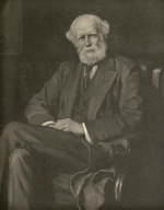
John Lubbock, first Lord Avebury, whose claims to
fame are many. He was a keen naturalist and
anthropologist; a friend and supporter of Charles Darwin
who lived at Downe; a banker, politician and social
reformer. He saved Avebury stone circle from
developers and was responsible for introducing bank
holidays. He died in 1913.
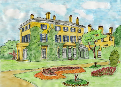
The house burned down in 1967 but the estate survives
for public use in the ownership of the London Borough of
Bromley.
There is a
Nature Centre open from 11 to 4 on Saturdays and
Sundays and a
café open daily from 9:30 until 5:00 (4:00 in
winter).
Downe Church
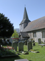
In the churchyard is a memorial to Charles Darwin,
his wife Emma and his brother Erasmus. However
Charles is not buried here as he had wished, but in
Westminster Abbey.
Public Transport
Bus service R8 runs from Orpington railway station to
High Elms and then to Downe which might be a more
convenient starting point for those not using a car.
In addition to the walking routes on our web site we
have published three popular walking guides:
Guide to Tunbridge
Wells Circular Walk and other walks in the area
Guide to the
Kent Coast Path: Part 1, Camber to Ramsgate
Guide to Three
River Valley Walks in West Kent: Darent Valley Path,
Eden Valley Walk and Medway Valley Walk
Please report any problems with this walk to
info@kentramblers.org.uk.
Ramblers' volunteers in Kent work tirelessly to
ensure that our paths are as well protected and
maintained as possible. Of course we also organise
led walks but most of our members are independent
walkers who simply want to support our footpath work.
Please
join us and become a supporter too. You need
us and we really need you.
Map contains Ordnance Survey data © Crown copyright
and database rights 2021. Some paths on map are based
on data provided by Kent County Council but do not
constitute legal evidence of the line of a right of way |