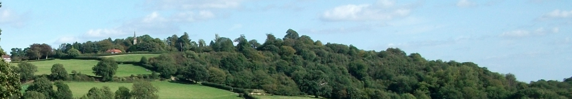
Toy's Hill and Ide Hill
Distance: 4.7 Miles (2h)
OS Map: Explorer 147 (Start at grid
reference TQ469517)
Click map to enlarge and click
again to enlarge further
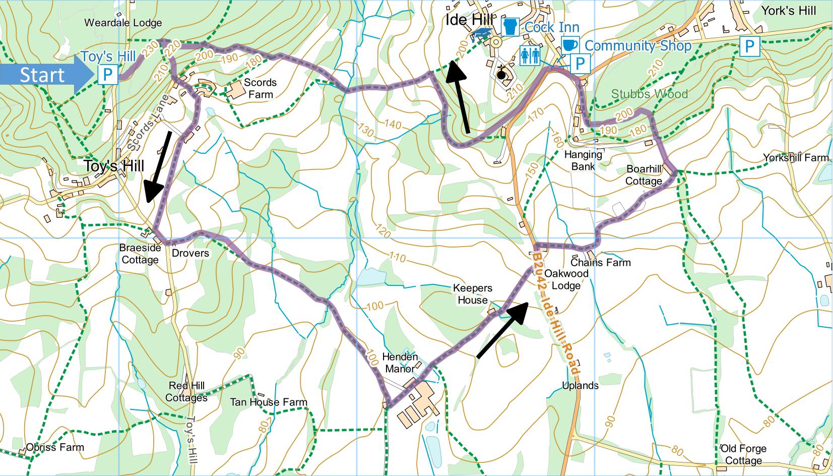
Park in the free car park at Toy’s Hill.
Leave car park by entrance and cross road to footpath
opposite. Pass information board and take left
fork. At junction of five paths with two waymark
posts, take path just right of straight on (second
right). Just a few metres down path, turn sharp
right onto path that descends quite steeply, leading to
steps down to Scords Lane. Go straight across,
down drive that leads to Scords Farm. When drive
bends sharp left, take footpath on right at corner
downhill between fences.
On emerging in another drive with metal gates
opposite, go through right hand gate. Carry
straight on to metal gate ahead and go through into
field. Follow path across field and into another
field. Half way across, on passing corner of wood
that sticks out into field on left, bear slightly right
and climb up to kissing gate adjacent to field gate in
hedge. Go through gate into Toy’s Hill Road.
Turn left downhill. As soon as road bends
slightly right, take track on left just before house
(Drovers). Pass one field gate and just before
another, go through kissing gate on right. Bear
diagonally left downhill across clearing to gate at
lowest corner. Go through gate and cross left hand
edges of two fields.
Through next gate bear along track (stony at first,
then concrete) bearing right uphill towards Henden
Manor. Track forks. Left fork leads to where
you want to go, but right of way goes down right fork
and then turns left in front of pair of houses, so that
you go along two sides of triangle. Follow track
through farm, keeping left past Henden Manor behind tall
hedge and continue, passing Keepers House, until you
reach Ide Hill Road (B2042). Turn left up road for
100 metres then turn right along track.
When you reach Chains Farm, keep left and go through
(or past) a couple of kissing gates into large field.
Don’t go through gateway immediately on left but a few
metres further on bear left for 50m then right, climbing
steadily with hedge on left and falling ground and
panoramic views including Bough Beech Reservoir on
right. Keep climbing past small pond to Boarhill
Cottage. Go through gate into lane and turn left
up hill. When lane bends sharp left, take path
(SR243) on right that goes steeply uphill through
Hanging Bank wood with several sections of steps and
handrails; ignore right turn. When you reach
broader, more level path at T-junction, turn left and
follow to grass mini-roundabout. Take farthest
track on right along fence and follow downhill to
Wheatsheaf Hill (B2042).
Turn left along road, getting fine view of Bough
Beech Reservoir on left. Cross to car park on
right and keep to left of toilets (there is a 40p charge
for toilets and Community Shop above toilets serves
refreshments) to cross side road and enter National
Trust woodland of Ide Hill. Keep left and follow
path that runs parallel with road, initially climbing,
next descending and then climbing again to stone seat
commemorating Octavia Hill. Carry straight on past
seat to triple fork in path. Right fork carries
the Greensand Way, but you should take left fork.
Descend through wood, cross two streams and then ascend
along edge of wood (which should be on your right).
When wood finishes go through gate and turn sharp left
downhill. Initially hedge is on your left but near
bottom, after section with no hedge, it is on your
right.
Cross footbridge over stream and go straight uphill
across middle of field, through gate (installed by
Sevenoaks Ramblers in memory of John Charles) between
two copses and on to gateposts at top of field.
Turn left along field edge until you reach bench
offering more fine views of Ide Hill and glimpses of
Bough Beech Reservoir. Just past bench, go through
gate into the wood. Follow path (Greensand Way)
uphill, ignoring any side paths, until you return to
junction of five paths that you passed at beginning of
walk. Take second path on left to return to car
park the way you came.
|
Points of Interest
Henden Manor

Henry VIII stayed at Henden when
visiting Anne Boleyn at Hever Castle.
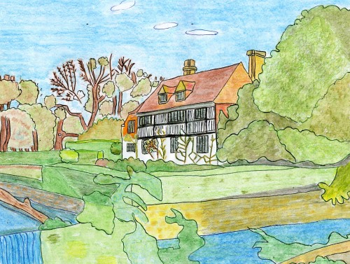
The current house is 16th century (the date 1577 is
carved on a panel in an upstairs room) and much
restored. The estate used to have a large dairy
herd but this was unprofitable and has gone.
Ide Hill
This pleasant village was first mentioned in records in
1258, although its then name Edythshyll is of Saxon
origin suggesting that the village pre-dated the Norman
conquest. The village had no church until one was
built in 1807 and replaced with the present St Mary’s
church in 1865. It seems that no one from the
village has ever made their mark on history. There
is a pub, the Cock Inn beside the large village green,
and a community shop with a café, the latter close to
the route of this walk.
Octavia Hill (1838-1912)
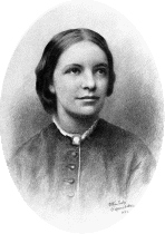
A campaigner for better housing for the London poor,
Octavia Hill had a cottage at nearby Crockham Hill and
was involved in founding both the Commons Protection
Society (now the Open Spaces Society) and the National
Trust.
Public Transport
Unfortunately there are no bus or rail services
convenient for this walk.
In addition to the walking routes on our web site we
have published three popular walking guides:
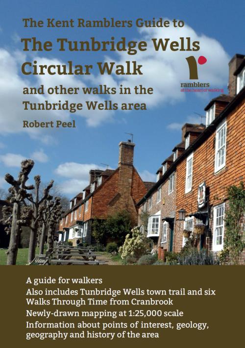
Guide to Tunbridge
Wells Circular Walk and other walks in the area
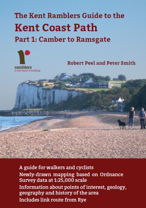
Guide to the
Kent Coast Path: Part 1, Camber to Ramsgate
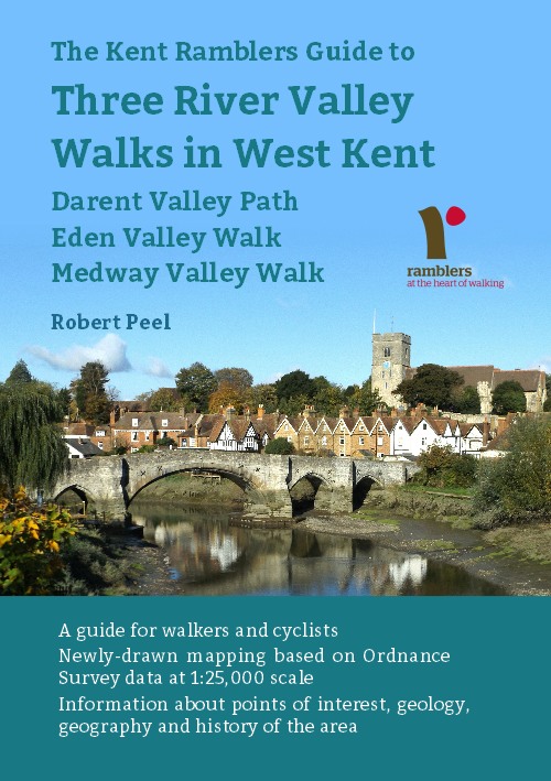
Guide to Three
River Valley Walks in West Kent: Darent Valley Path,
Eden Valley Walk and Medway Valley Walk
Please report any problems with this walk to
info@kentramblers.org.uk.
Ramblers' volunteers in Kent work tirelessly to
ensure that our paths are as well protected and
maintained as possible. Of course we also organise
led walks but most of our members are independent
walkers who simply want to support our footpath work.
Please
join us and become a supporter too. You need
us and we really need you.
Map contains Ordnance Survey data © Crown copyright
and database rights 2021. Some paths on map are based
on data provided by Kent County Council but do not
constitute legal evidence of the line of a right of way |