Kent Ramblers

Walk 64

Walk 64: Walmer, the White Cliffs and Dover

Distance:     6.1 Miles (3 Hours)
OS Map:      Explorer 138 (Start at grid reference TR 314415)
Start at Walmer Station.

Click to view larger map

From Walmer Station go downhill in Station Road, turn L and follow Station Road to the junction of the main Dover Road.  Turn L, pass a church and cross the main road with care immediately after Church Street.  Go ahead on footpath along alleyway.  After alleyway ends follow road past church and turn R into St Clare Road.  Follow the road to junction then turn L and head downhill on Grams Road. 

At the bottom cross the road with care and fork R, following the Public Footpath sign, bringing you out on Hawkshill Common (A).  Cross this diagonally R, bringing you to the memorial seat for Charles Wake.

Follow a path between fields enclosed by fences, and ignore a L turn.  At the end there are fine views across the Channel.  Follow the path ahead of you between fields to trees. Bear L to pass between wooden posts to a minor road.  Follow this to the end and turn L, then turn R onto road at Saxon Shore Way sign.  Follow the road to a bend and climb a flight of steps. You are now walking on the White Cliffs.

Follow the cliff path past the golf course and continue to the Dover Patrol memorial at St Margaret’s (B).  Here there is a café (called – appropriately – Blue Birds) so it is a good spot to stop for lunch.

At the memorial turn L through one of the kissing gates, then bear R and follow the cliff top path. You will pass some steps on the L which lead down to St Margaret’s Bay, (C) another good spot for lunch. But be warned – the steps are steep, and if you go down to the bay you will have to climb back up them. If you don’t wish to visit the Bay, follow the cliff top path to a road (NB for people wishing to stop the walk here, turn R and follow the road – with GREAT CARE – for approx. half a mile to the village of St Margaret’s at Cliffe, where there is a bus service back to Walmer). 

Follow the road downhill and when it bends L, bear R on a rough road, then turn L onto Beach Road.  Follow this, shortly passing the Pines Gardens (D), and at a junction of paths bear L to a SSW marker post, go up steps, through a kissing gate and uphill.  At the top turn R on a chalk track and follow this to South Foreland Lighthouse (E).

Turn L on a path back to the cliffs.  Turn R and follow cliff top path, skirting around a bowl-shaped depression, Fan Hole. Fine views of Dover Harbour are now coming into view. Skirt around the next bowl-shaped depression, Langdon Hole, and follow the path to reach some steps with a handrail.  Keep following the path to the Gateway to the White Cliffs Visitor Centre (F).

Follow the road past the National Trust kiosk, then bear L to descend steps which take you under one of the two main roads into Dover (G) – Jubilee Way on the A2 – to some houses.  Go straight on and turn L and then R to cross Dover’s other main road – the A20 - at a pedestrian crossing.  Turn R onto the seafront and follow this to the Royal Cinque Ports Yacht Club.  Turn R, go through an underpass, then turn L and R into York Street.  Follow this, crossing at another pedestrian crossing, then turn L into Folkestone Road to Dover Priory Station.

This walk was originally published on a calendar produced by White Cliffs Group.  Thanks to Graham Smith for originally devising this route, Rob Riddle for the photograph, Diana Blackwell for checking the directions and Andrew Boultbee for the idea.

Public Transport

Starting and finishing at different stations, this walk is an ideal choice for access by train or bus.

Places of Interest

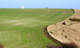
A Hawkshill Common is an area of open land offering fine views out to sea – on clear days you can see France. The common has several memorial benches, including one for Charles Wake, the first chairman of the White Cliffs Ramblers, who died, aged 85, in 1999, shortly before our Group’s 10th anniversary.

B The Dover Patrol Memorial at St Margaret’s marks the work of the Dover Patrol in defending the Channel in both world wars. A similar memorial is at Cap Blanc-Nez across the Channel in France – which, on a very clear day, can be seen from the St Margaret’s one.

C St Margaret’s Bay, just off route, is well worth a visit. Its attractions include – a short distance on your left at the bottom of the steps - a house once lived in by Ian Fleming, author of the James Bond books. There is also a pub (The Coastguard) and an outdoor snack bar.

D Features of the Pines Garden, at St Margaret’s Bay, include a cascade and adjoining lake, a statue of Sir Winston Churchill – who regularly visited the Dover coast, which was nicknamed Hellfire Corner during the last war – and the Pines Calyx building, which has won awards for its environmentally-friendly design.

South Foreland Lighthouse

E The South Foreland Lighthouse was built to guide shipping through the Strait of Dover and the Downs, a stretch of water between Deal and Dover where over the centuries ships have taken refuge from rough seas.

F The Gateway to the White Cliffs visitor centre, managed by the National Trust, has some excellent displays illustrating the geology and history of the White Cliffs. Overlooking the Port of Dover on Langdon Cliffs, it also offers some superb views – which you may wish to enjoy while taking some refreshments from the centre’s café.

Dover Harbour

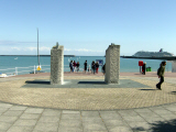
G Dover Harbour is one of the busiest passenger sea ports in the world, and the gateway to Europe. Cruise ships regularly call in at the port’s cruise terminal, built on the site of Dover Marine Station, and can make a very impressive sight.


Our book of Ten Favourite Walks in the Kent Countryside has routes for ten more walks like this one.

Ramblers' volunteers in Kent work tirelessly to ensure that our paths are as well protected and maintained as possible.  Of course we also organise led walks but most of our members are independent walkers who simply want to support our footpath work.  Please join us and become a supporter too.  You need us and we really need you.


If you find that the directions and map for this walk are incorrect in any way, please report the problem to info@kentramblers.org.uk.


Map based on Ordnance Survey mapping released into the public domain under the OpenData agreement.

home | getting started | support us | contact us | path problems