|
To order books, either
Send a cheque payable to Kent Ramblers to 15 Woodland Way, Petts Wood, Orpington, Kent, BR5 1NB
or
If you would like to pay by direct
transfer into our bank account, email books@kentramblers.org.uk
for instructions – put “Ramblers Books” in the subject line and
your name, address and the products you would like in the body
of the email. Check for updates
and corrections here |
Products Available
We have for sale the following items for walkers
in Kent:
Guide to the
Wealdway
Guide to the
Tunbridge Wells Circular Walk
Guide to Three
River Valley Walks in West Kent
Guide to Kent Coast Path: Part
1: Camber to Ramsgate
We also offer the
following items at no charge apart from P&P: 10 Favourite Walks in the
Kent Countryside
Annual
Reviews All profits from publication
sales are used to support the work of the Ramblers.
We can only despatch to UK addresses.
For guides from other publishers, please visit our
Links page. |

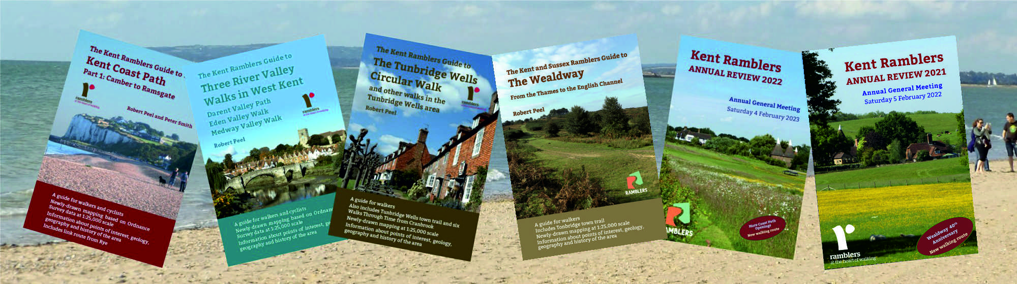
Superbundles
Get a copy of every publication on this
page for just £15.50 including P&P.
What a bargain (and you help fund our
work too)!
Buy any three books for £13.
Buy any two books for £10.
|
Latest Book
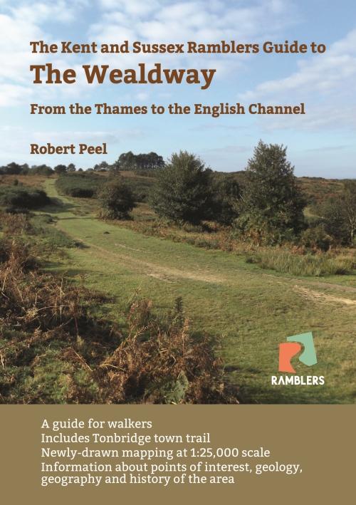
Front Cover
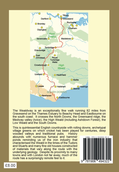
ISBN: 978-1-906494-32-2
(978-1906494322)
Published August 2023
|
The Wealdway
The Wealdway is an exceptionally fine walk running 82
miles from Gravesend on the Thames Estuary to Beachy
Head and Eastbourne on the south coast. It crosses
the North Downs, the Greensand ridge, the Medway valley
(twice), the High Weald (including Ashdown Forest), the
Low Weald and the South Downs.
This is quintessential English countryside with
rolling downs, archetypal village greens on which
cricket has been played for centuries, deep wooded
valleys and traditional pubs. History abounds with
numerous furnace and hammer ponds reminding us of the
iron industry that characterised the Weald in the times
of the Tudors and Stuarts and many fine old houses
constructed of materials that vary along the route with
the underlying geology. Despite its proximity to
many towns and with London not far away, much of the
route has a surprisingly remote feel to it.
The book offers a full description of the route,
newly-drawn maps at 1:25,000 scale, background
information on geology, history and landscape evolution
and numerous illustrations, all in full-colour.
The cover price is £8.00 but we are currently
offering copies for £7.50 including
postage and packing. For better value still, try
our Superbundle – see top right of page –
every publication on this page for just £15.50.
|
Back Cover |
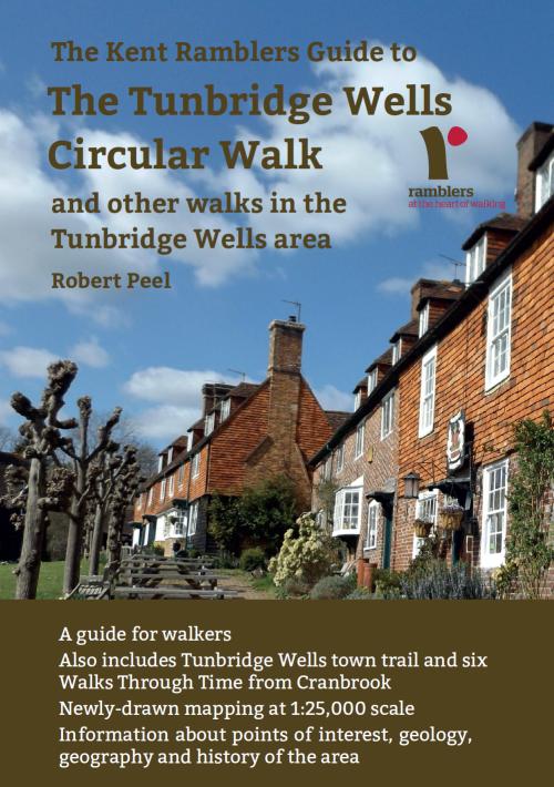
Front Cover
ISBN: 978-1-906494-80-3
(978-1906494803)
Published August 2020
|
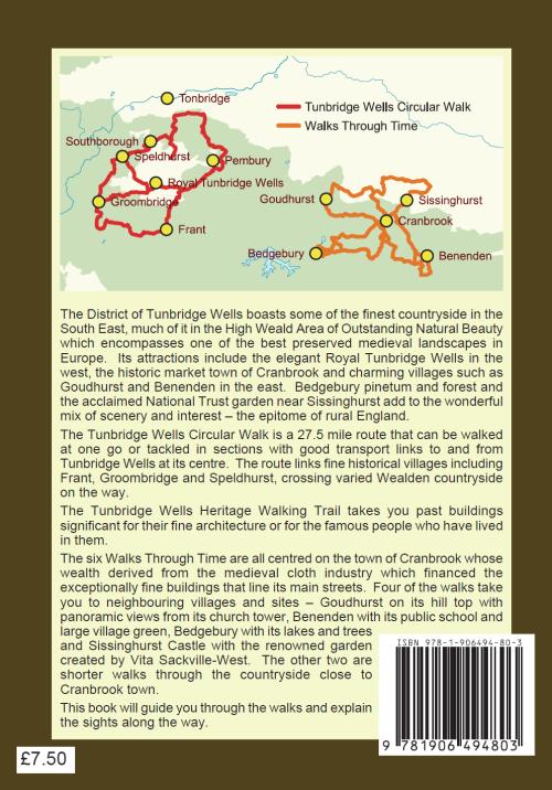
The Tunbridge Wells Circular Walk
and other walks in the Tunbridge Wells area
The Tunbridge Wells Circular Walk is a 28.5 mile ring
through the fine countryside around the town with four
routes joining various points on the ring to transport
services in or linked to the town centre.
The town trail is a 3.2 mile allows the walker to
appreciate the fine architecture and historical
connections of Tunbridge Wells's many attractive
buildings.
The six Walks Through Time are centred on the
historic market town of Cranbrook and pass through some
exceptionally fine Wealden scenery.
The guide includes route directions, 1:25,000 full
colour maps, advice on public transport, descriptions of
points of interest and background information to
facilitate interpretation of the ancient Wealden
landscape. The guide is in full colour and
profusely illustrated.
The cover price is £7.50 and we are currently
offering copies for this price to include
postage and packing. For better value still, try
our Superbundle – see top right of page –
every publication on this page for just £15.50.
|
Back Cover |
Front cover
ISBN: 978-1-906494-76-6
(978-1906494766)
Published October 2018
Read customer comments here |
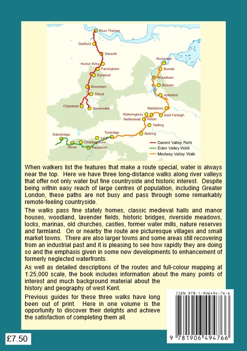
Three
River Valley Walks: Darent Valley Path, Eden Valley Walk
and Medway Valley Walk
There had been no guides in
print for these fine walks for many years when in September 2018
we published this 80 page book, which covers
them all. It offers full-colour maps at 1:25,000
scale, detailed directions, descriptions of points of
interest and background information about geology,
landscape and buildings.
The
Darent Valley Path starts
alternatively at Sevenoaks Station or Chipstead and
finishes on the bank of the Thames just north of
Dartford.
The
Eden Valley Walk starts a
few miles south west of Edenbridge and finishes at
Tonbridge Castle.
The
Medway Valley Walk starts
near Tonbridge Castle and finishes at Rochester, passing
through Maidstone on the way.
The cover price is £7.50 and we
are currently offering copies for this price to include
postage and packing. For better value still, try
our Superbundle – see top right of page –
every publication on this page for just £15.50.
|
Back cover |
|
Front cover
ISBN: 978-1-906494-71-1
(978-1906494711)
Published October 2016 Read customer comments here
|
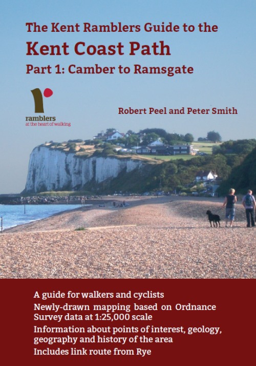
Kent Coast Path: Part 1: Camber to
Ramsgate
This 80 page guide covers the first section of the
England Coast Path to be opened in Kent. Ramblers' volunteers have been labouring for
years both to get the path open and to prepare what we hope is the best
guide possible to the pleasures and interest of the route. The
path was formally opened on 19 July 2016.
This guide is in full colour with detailed
1:25,000 maps based on Ordnance Survey data and enhanced by the local
knowledge of the authors and others in Kent Ramblers. There are
full descriptions of the route and of the many points of interest that
you will pass along the way.
There is also much background material about the
history, geology and geography of the area.
The cover price is £7.50 and we
are currently offering copies for this price to include
postage and packing. For better value still, try
our Superbundle – see top right of page –
every publication on this page for just £15.50.
|
Typical page |
|
Our book of
walks
A page from the book
ISBN: 978-1-906494-49-0
Check for updates and corrections
here |
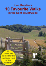
10 Favourite Walks in the Kent Countryside
This is our own book of ten walks in Kent. 24 pages
including cover.
There are walks all over the county of lengths
from 3 to 11 miles. Each walk is described in detail
with a full-colour map and points of interest
are identified.
As this book is now over ten
years old and is not completely up to date, we are no longer
offering it for sale. However, we still have copies which we
will be pleased to supply free of charge to those purchasing other
products on the understanding that on some routes there may have
been changes since the book was written. Although the book
itself is free, there is a charge of 90p to cover additional post
and packing except that when ordering either the £15.50 Superbundle
or the £13.00 Superbundle there is no
additional charge. If you wish to take
advantage of this offer, please say so when making your other
purchase(s). |
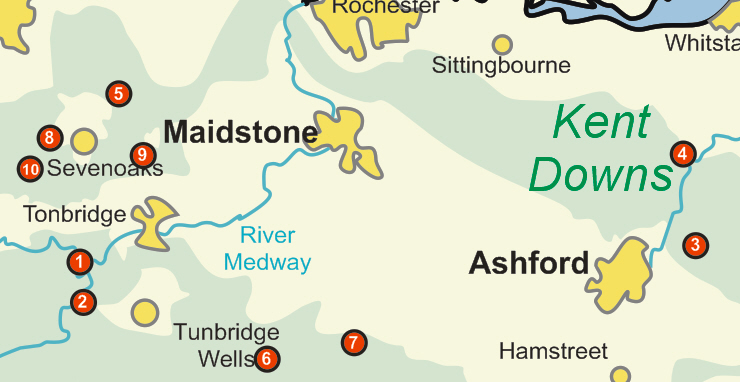
Contents
1. Penshurst and Blowers Hill (4.9 miles)
2. Fordcombe and Avery’s Wood (5.3 miles)
3. Devil’s Kneading Trough and Crundale Church (6.7 miles)
4. Chilham and Perry Wood (10 miles)
5. Kemsing (3 miles)
6. Scotney Castle and Bewl Water (9 miles)
7. Cranbrook and Goudhurst (10.8 miles)
8. Dryhill Nature Reserve and Whitley Forest (4 miles)
9. Ightham Mote, Godden Green and Stone Street (5.6 miles)
10. Emmetts Garden and French Street (5 miles)
|
|

|
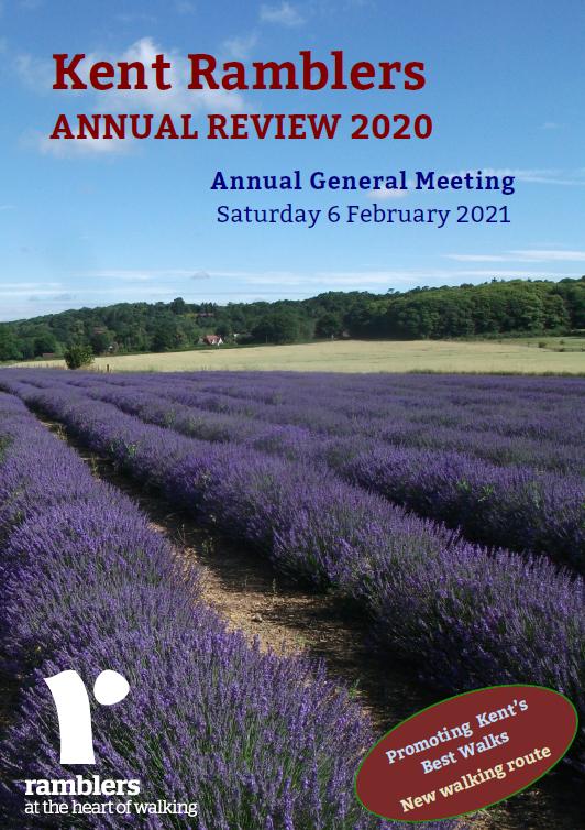
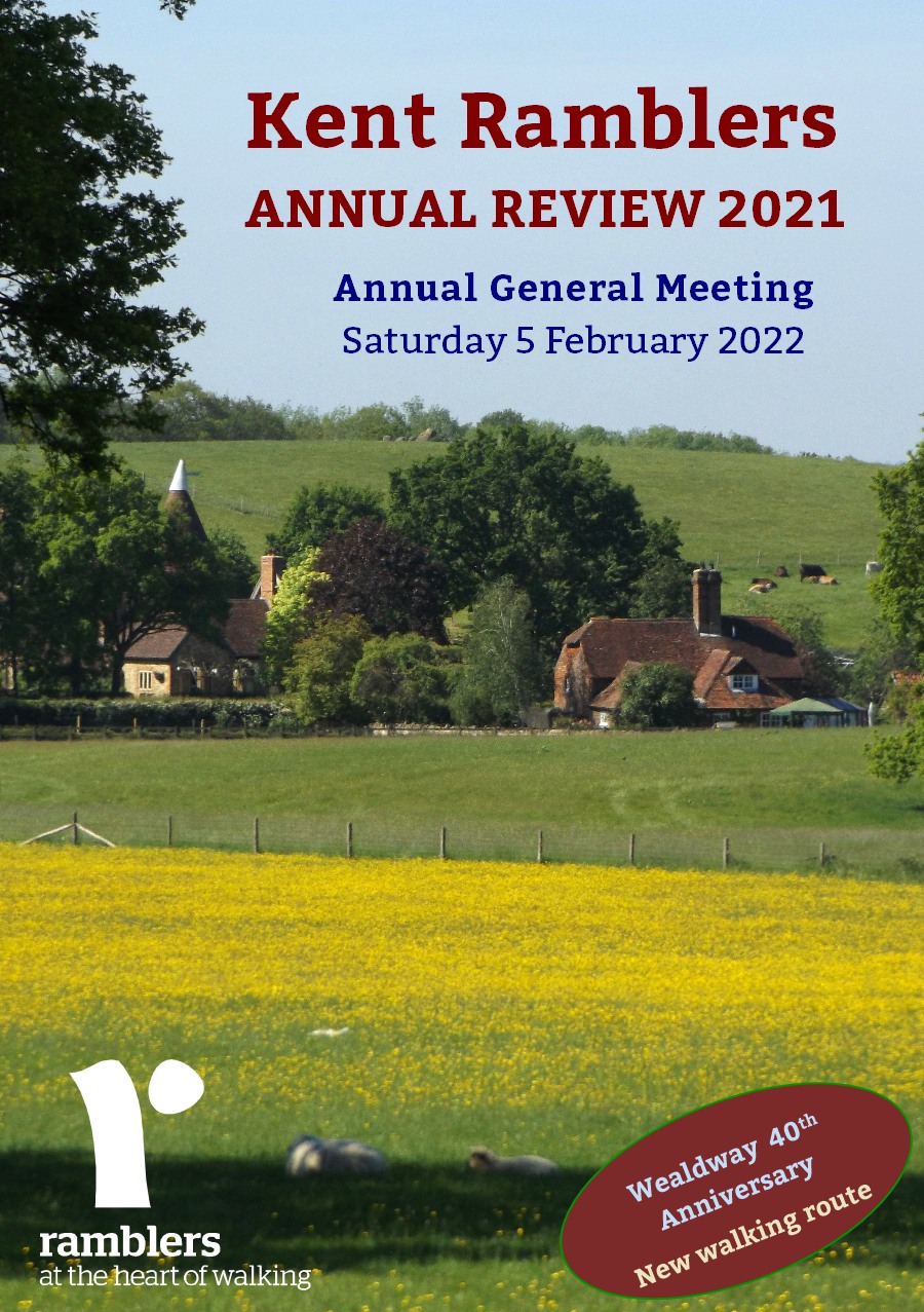
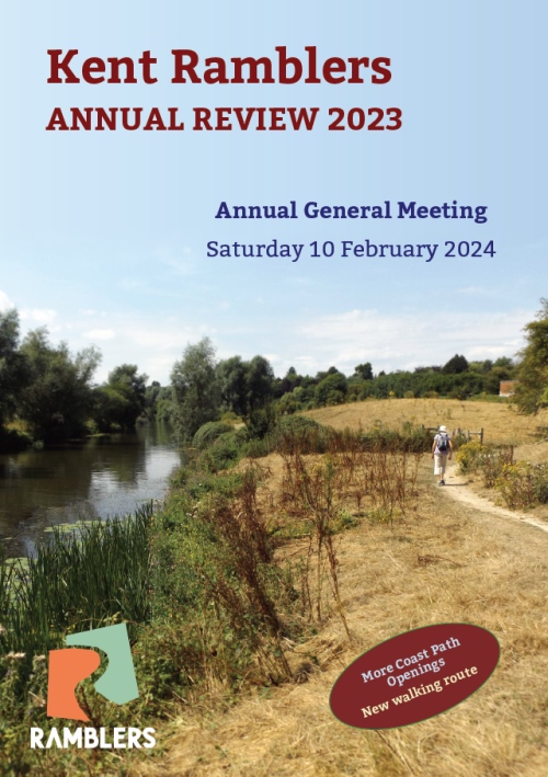
Annual Reviews
Our Annual Reviews contain not only more of our favourite walking
routes but also articles about subjects of interest to walkers in Kent.
The following are currently available:
2020. Walk 60: Stubbs Wood and
Whitley Forest
2021. Walk 181: Jeskyns to Luddesdown Circular
2022. Walk 12: Hosey Common and Chartwell
2023. Walk 67: Sandwich and the Sea
These are free of charge but postage and packing costs
are £1.75 (or available as part of the £15.50 or £13.00 Superbundles at
no additional cost). |
|