Foots Cray Meadows
Distance: 2.6 Miles (1h 15m)
OS Map: Explorer 162 (Start at grid reference
TQ474717)

Click map to magnify and click
again to magnify further
Parking. There is a free car
park at Foots Cray Place. If approaching from
Orpington, make for Crittal’s Corner, go under the A20
and take the opposite exit (the one for B&Q) and carry
straight on to the traffic lights at the bottom of
Sidcup Hill. Go straight across at the lights into
Rectory Lane. The lane bends sharply left at the
church and the entrance to Foots Cray Place is on the
right 250 metres past the bend.
From car park entrance turn left along private drive
to old stable block (all that remains of Foots Cray
Place). At corner, go through a gate on right,
bear left uphill past tulip tree standing alone and up
bank onto broad track where Foots Cray Place used to
stand. Turn right with boundary of Cleeve Park
School on left and woodland on right. At corner of
the wood, turn right along track. On emerging into
open meadow turn along edge of woodland. Cross
asphalt track leading from Five Arch Bridge on right and
continue across meadow, bearing right towards river
where fence around Royal Park Primary School juts out on
left. Pass very well-equipped children’s play area
and basket ball pitch. Bear right to footbridge
and cross river.
Turn right along riverbank and follow path parallel
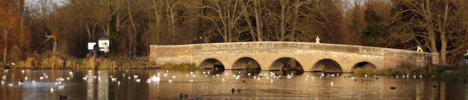
to river. Pass but do not cross Five Arch Bridge.
Continue past lake occupied by wide selection of water
fowl. Cross side stream by small bridge and
continue to another bridge, Penny-farthing Bridge (note
one large and one small arch), across Cray. Over
bridge, bear right at fork and head uphill back to car
park.
[Photograph of tulip tree by Bruce Martin licensed under
the Creative
Commons Attribution-Share
Alike 3.0 Unported license.]
In addition to the walking routes on our web site we
have published four popular walking guides:
|
Points of Interest
The Tulip Tree

According to legend, as Adam and Eve were expelled
from the Garden of Eden, Eve tried to grasp a branch of
the Tree of Life but succeeded only in snatching the tip
of a leaf from the tulip tree.
So the leaves of the tulip tree have veins
leading to a non-existent tip.
To see the fine tulip-like flowers, visit in
early June.
Five Arch Bridge
This is a legacy of the parkland of North Cray Place,
landscaped by “Capability” Brown in the 1780s.

The Cray was dammed to create the lake lying up river
from the bridge. North Cray Place was demolished
in 1962 and a housing estate built on the site.
The grounds became part of Foots Cray Meadows public
open space.
The elegant white mansion you may glimpse across
meadows on your left soon after crossing the bridge by
the play area is Loring Hall, now a care centre.
Under its previous name of Woollett Hall it was the
residence of British Foreign Secretary, Viscount
Castlereagh, from 1811 until 1822 when he committed
suicide in the house.
Foots Cray Place
The most recent mansion on the estate was built in
1754, one of four houses in England built to copy
Palladio’s Villa Rotunda in Italy. Two of the
others are Chiswick House and Mereworth Castle in Kent.
After use by the military in World War II, the house was
acquired by Kent County Council (Bexley was in Kent
until 1965) as a museum. Unfortunately it burnt
down in 1949 and what little remained had to be
demolished, the grounds becoming part of Foots Cray
Meadows.
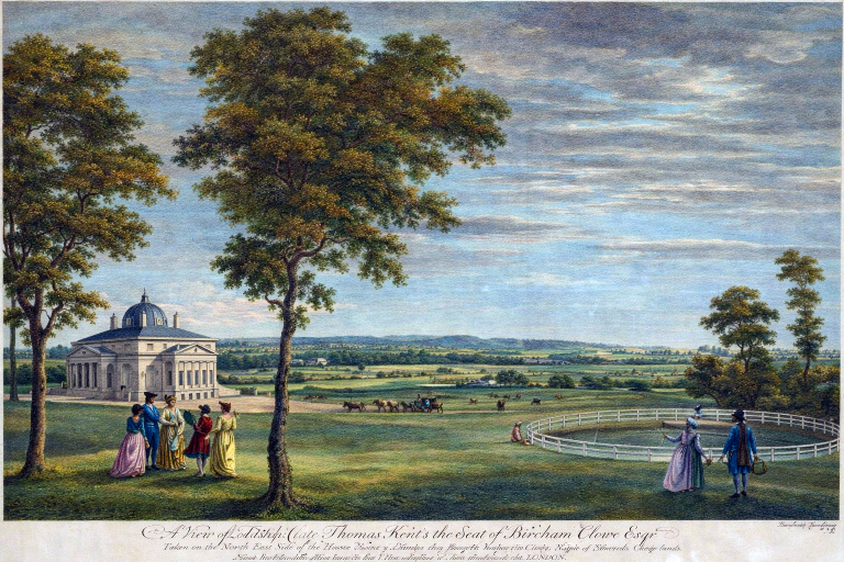
Foots Cray Place in a print of around 1760
Please report any problems with this walk to
info@kentramblers.org.uk.Ramblers' volunteers in Kent work tirelessly to
ensure that our paths are as well protected and
maintained as possible. Of course we also organise
led walks but most of our members are independent
walkers who simply want to support our footpath work.
Please
join us and become a supporter too. You need
us and we really need you.
|