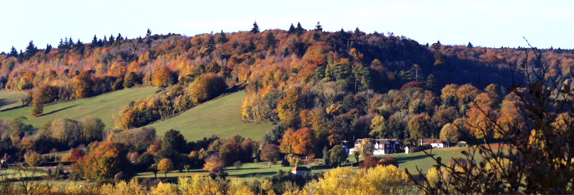
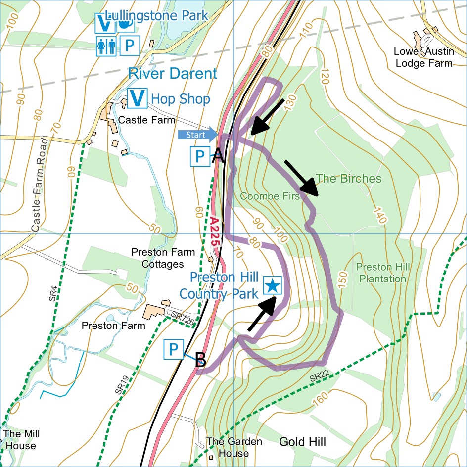
April: Preston Hill Country Park
Distance:
2.3 miles (1 hour)
OS Map:
Explorer 147 (Start at TQ529633)
Click map to enlarge and click
again to enlarge further
The Kent Downs National Landscape call this the
Unknown Country Park and there’s no reason to argue with
that. There are no facilities here apart from a
couple of conveniently placed lay-byes on the main road
for parking and a few information boards. If you
visit, you are likely to have the place to yourself
apart perhaps from a small herd of go. The views
across the Darent Valley are superb. Early on a
sunny morning in late October there can hardly be a
better place in Kent from which to appreciate the autumn
colours. The figure of eight route described here,
about 2.5 miles in total, is well waymarked and well
maintained.
The two lay-byes are marked A and B on the map; the
route described here starts at A. If heading south
along the 225 (Shoreham Road), having passed Castle Road
(signposted for Lullingstone Park Visitor Centre) look
for the Castle Farm sign on the right. Immediately
on the left are two lay-byes, a small one with a bus
stop which should be left clear and a larger one where
you can park.
From lay-bye go back past bus stop and take track on
right opposite entrance to Castle Farm. Cross
bridge over railway and go through kissing gate to left
of larger gate.
For first and smaller loop of walk, turn left
immediately and follow gradually rising path offering
increasingly fine views across the Daren Valley. Just
follow waymarks, in due course turning right quite
steeply uphill and right again along top of open area.
Descend gradually to information board close to kissing
gate mentioned above.
Turn sharp left uphill past boards and continue to
follow waymarks. At first point where there is any
choice of tracks, keep right and follow track round to
left. At next junction of tracks where what is
probably the track you didn’t take last time joins from
left, turn right with open field over hedge on left.
At end of field go through gate to information board and
turn right downhill.
When track is about to turn left (it leads to lay-bye
marked B on the map), go through gate on right and turn
right. Soon reach sign offering choice between
steep and level routes and make your choice. The
routes soon merge again along track contouring along
bottom of open area. Go through gate and left
along downhill track. When track bears left at
bottom, go through gate on right and along path, leading
back to information board where you started. Turn
left down to gate then over railway bridge back to road.
If starting from lay-bye at B, which is larger than
the one at A, go through the gate and up track, soon
bearing left and climbing steadily with good views.
When track turns right, go straight forward through gate
and follow instructions at start of previous paragraph.
In addition to the walking routes on our web site we
have published four popular walking guides:
|
Points of Interest
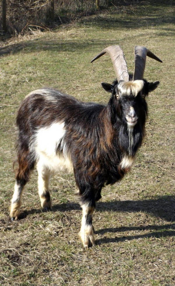
The site is a Site of Special Scientific Interest
(SSSI). To prevent succession to scrub the
grassland is sometimes grazed by goats, said to come
from the Great Orme in North Wales.
Public Transport
Point B on the map is only
two-thirds of a mile from Shoreham Station but the verge
along the A225 is quite narrow. Footpaths SR19 and
SR726 provide a pleasant route to point A. Point A
is also served by bus service No. 2 between Swanley and
Sevenoaks – it runs only twice a day (not at all on
Sundays) but with planning it might be a viable option
for this walk.
Please report any problems with this walk to
info@kentramblers.org.uk.
Ramblers' volunteers in Kent work tirelessly to
ensure that our paths are as well protected and
maintained as possible. Of course we also organise
led walks but most of our members are independent
walkers who simply want to support our footpath work.
Please
join us and become a supporter too. You need
us and we really need you.
Map contains Ordnance Survey data © Crown copyright
and database rights 2025. Some paths on map are based
on data provided by Kent County Council but do not
constitute legal evidence of the line of a right of way.
|