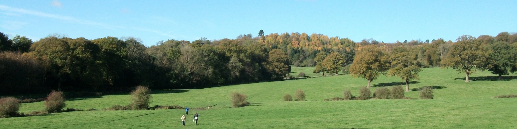
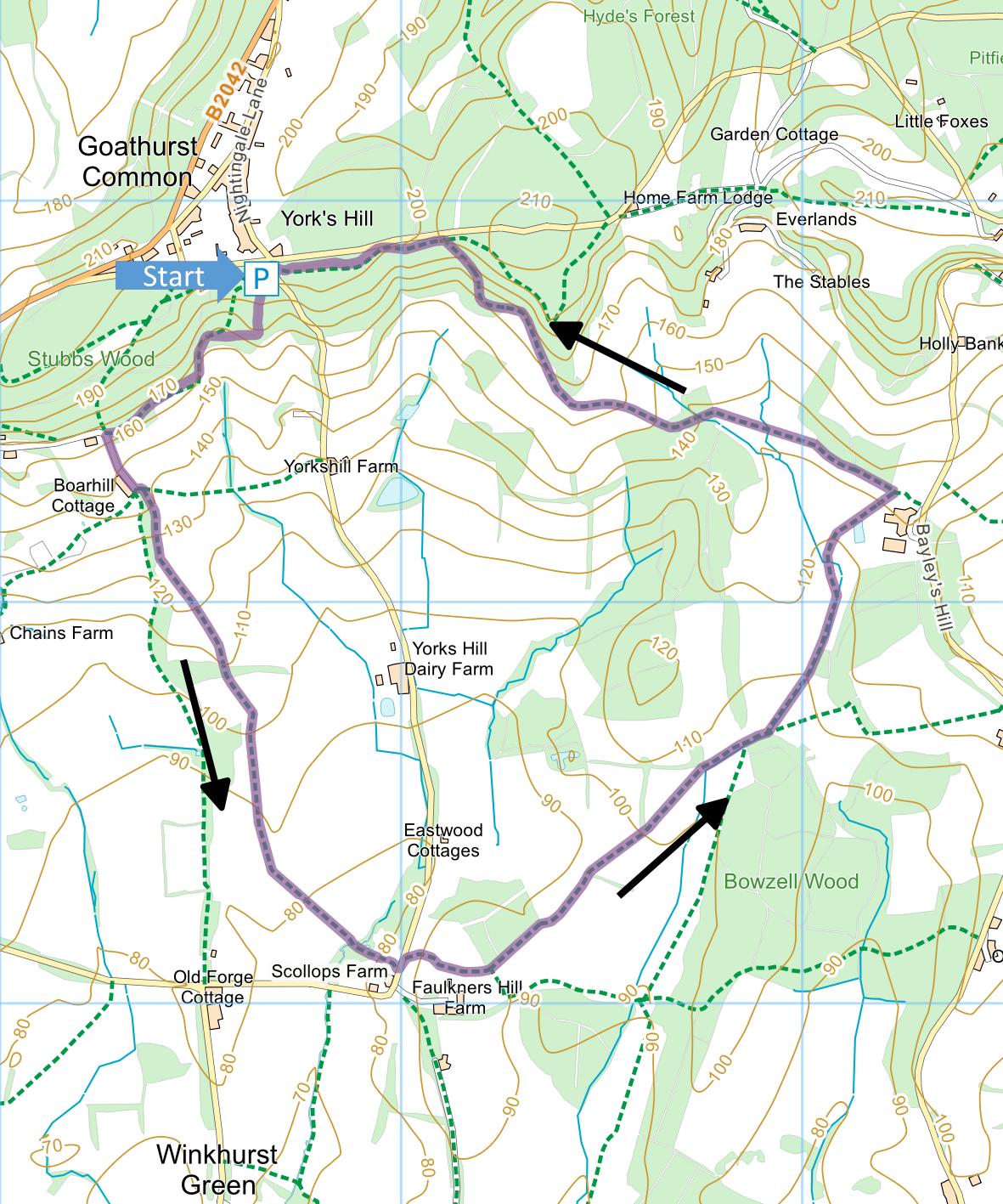
Stubbs Wood and Scollops
Farm
Distance: 3.8 Miles (1hr 45 mins)
OS Map: Explorer 147 (Start at grid
reference TQ497518)
Click map to enlarge and click
again to enlarge further
Park at Stubbs Wood car park (free). This is
best approached from Ide Hill. When the road from
Ide Hill meets the B2042 near car park and toilets, turn
left onto it. Go up the hill and turn right
immediately after the Goathurst Common sign.
Continue for 500 yards to first right turn. Turn
right but instead of going down Yorks Hill, go into the
car park.
Leave the car park by the steeply descending path
behind the Hanging Bank information board turning right
at bottom along lower edge of wood On reaching
lane turn sharp left and when lane ends bear left to far
gate. Do not go through gate but instead take
downhill path on the right immediately adjacent to gate.
Follow right hand edge of field between fence on left
and hedge on right. At bottom of slope, enter
another field and bear left across it, climbing gently
and then descending again towards strip of woodland.
On far side, cross another field and go through hedge.
Follow left hand edge of next field to gap in corner,
then bear left across corner of another field to large
oak half way along its left hand edge. Continue
along left hand edge of field and into woodland.
Cross a footbridge, follow path left and right, then
over stile, across a garden and through gate into lane
near Scollops Farm.
Turn left for a few metres then, opposite Scollops
Cottages on the left, take a footpath over a stile on
the right. Climb steeply to the highest point of
the field and bear left to the far corner. Go
through a gate, along edge of wood, through second gate
and then over stile to right of field gate. Cross
field to another stile; cross next field diagonally to
stile middle of opposite side; pass some trees into
another field and go diagonally across to far right
corner. Cross right hand edge of yet another field
– with stream over fence on right. At corner go
through gate.
Bear left over footbridge with and follow right hand
edge of field, initially with wood on right. At
corner bear left to footbridge go through gate into next
field. Make for gate at top left corner of field –
right of way goes up right hand side field then left
across top.
In next field, bear slightly left and downhill
through gap in next hedge, making for gate into wood
opposite. Go through wood and on emerging bear
left uphill to electricity pole. Bear left to
kissing gate beside larger gate and go through.
There are fine views of Bough Beech Reservoir here.
Ignore metal gates into wood on right and continue
outside bottom edge of wood to stile. Follow path
along bottom of wood (but now inside) and at fork take
steep uphill path on right. At the top meet
broader path at post bearing collection of waymarks,
including one for Greensand Way. Turn left and
soon pass seat under large beech tree – this used to
offer fine views of reservoir but trees below have now
grown high enough to obscure reservoir. Continue
along path back to car park.
|
Points of Interest
Hanging Bank
Views differ on the origin of this name. One
author suggests that there was once a gallows here but
the Kent CC information board denies this, suggesting
that the name indicates the wood “hanging” on the
hillside.
Yorkshill Farm
A Grade II listed 15th Century “Wealden Hall House”.
However, the timber frame that is characteristic of such
houses is obscured behind a late 18th century brick
front and considerable modern extensions to the rear.
Hatchlands Farmhouse
A Grade II listed villa of around 1840.
Greensand Way
This long distance walk follows a 108 mile route
through Surrey and Kent from Haslemere to Hamstreet.
Public Transport
Unfortunately there are no convenient bus routes
serving this walk.
Please report any problems with this walk to
info@kentramblers.org.uk.
Ramblers' volunteers in Kent work tirelessly to
ensure that our paths are as well protected and
maintained as possible. Of course we also organise
led walks but most of our members are independent
walkers who simply want to support our footpath work.
Please
join us and become a supporter too. You need
us and we really need you.
Map contains Ordnance Survey data © Crown copyright
and database rights 2023. Some paths on map are based
on data provided by Kent County Council but do not
constitute legal evidence of the line of a right of way.
In addition to the walking routes on our web site we
have published four popular walking guides:
Guide to the Wealdway
Guide to Tunbridge
Wells Circular Walk and other walks in the area
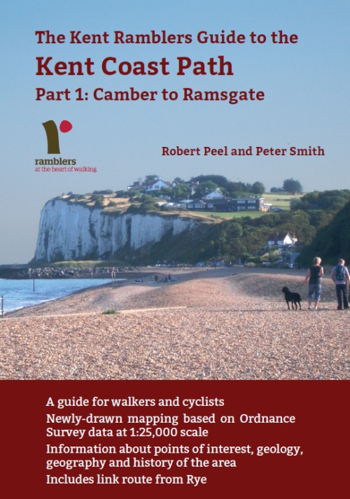
Guide to the
Kent Coast Path: Part 1, Camber to Ramsgate
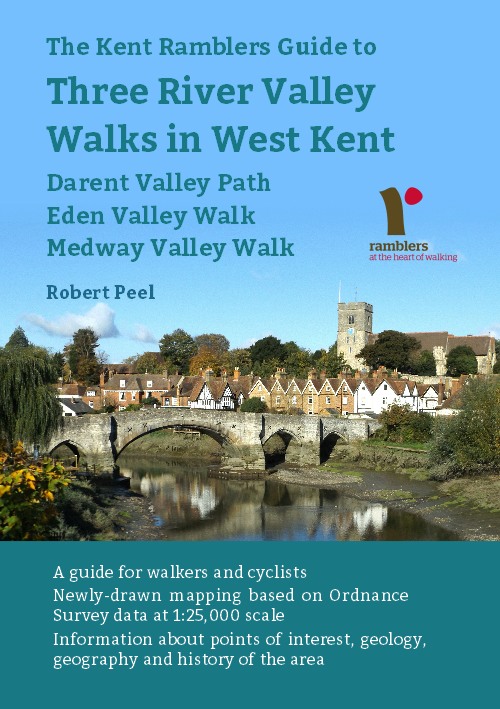
Guide to Three
River Valley Walks in West Kent: Darent Valley Path,
Eden Valley Walk and Medway Valley Walk
|