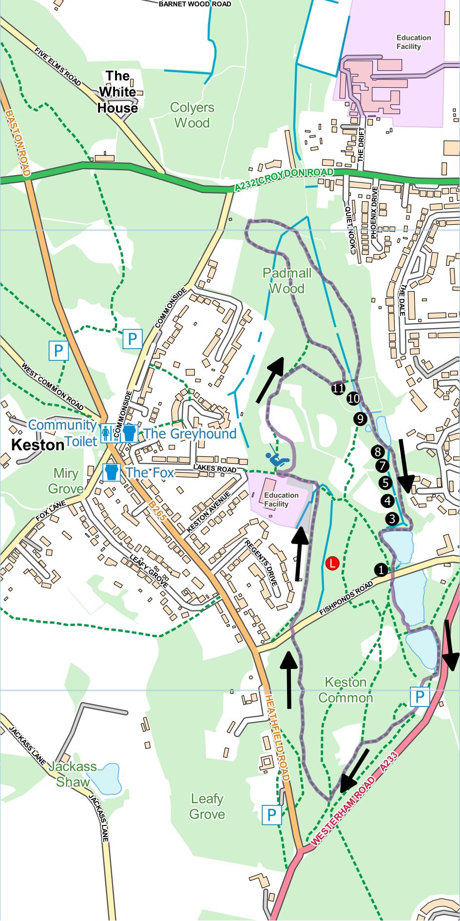
Keston Ponds and Padmall Wood
Distance: 2.1 Miles (1 hour)
OS Map: Explorer 147 (Start at TQ419639)
Click map to magnify and click
again to magnify further
Park in the free car park off Westerham Road.
Numbered circles on map represent concrete posts bearing
red numbers that are part of an old nature trail.
Initially the route follows the waymarked Three
Commons Circular Walk (TCCW).
Go up the steps at the south end of the car park and
follow path above edge of small valley on left.
Follow waymarks for Three Commons Walk. At
T-junction where path on left leads to road, take a
waymarked right turn along a broad track that descends
into a hollow (don’t take bridleway on right).
Follow the Three Commons Walk waymarks along the valley
bottom, bearing left at a junction near the lowest point
and then right after a couple of metres. When you
reach Fishponds Road bear right across and follow the
waymarks downhill to a T-junction. Turn left and
cross a plank bridge to an asphalt path passing school
on left.
Leaving the Three Commons Circular Walk, go through
gap on right to children’s playground. Don’t enter
but turn right to skirt two sides of playground,
emerging in open field at far corner. Cross field
and take path into woods, bearing right downhill towards
stream.
Approaching bottom of path, turn left just before
bridge and keep left uphill through Padmall Wood.
At far end is open space and information board where you
re-join the Three Common Circular Walk. Keep right
of information board, over duckboards and across stream.
Follow path, ignoring right turns, back to stream.
Keep stream on right for a while, follow path sharp left
at post “9” then sharp right to cross stream.
Pass concrete post “8” on right and pond on left.
Follow track to reach lowest of Keston Ponds.
Cross bottom of pond, then turn left along bank of pond
and up steps to Fish Ponds Road.
Cross road and follow edge of next pond. At far
end of pond, take path between two ponds and at far side
turn right along bank of upper pond to Caesar’s Well.
Climb steps back to car park.
|
Points of Interest
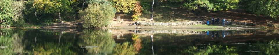
Keston Ponds
The three obvious ponds were built as reservoirs to
supply water to nearby Holwood House, once the residence
of William Pitt, later a seismological research
institution and recently converted into up-market
apartments.
Caesar’s Well

A natural spring, the source of the Ravensbourne
River. So-named because of a myth that Caesar once
camped nearby and was short of water for his men.
He spotted a raven frequently visiting the site and
correctly deduced that there must be a source of water
there. Hence the names of both the spring and the
river (“bourne” being a variation of “burn” meaning
“stream”).
Keston Bog
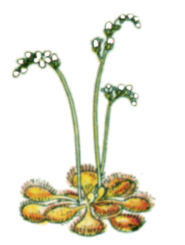
The point on the map marked with a red-circled L is
Keston Bog. This wetland environment is rare in
London and is a site of special scientific interest
(SSSI). It was here that Charles Darwin studied
the sundew and discovered that it captures and digests
insects to obtain the nitrogen that is so scarce in
wetland soils.
Padmall Wood
The wood is largely sweet chestnut and birch coppice.
Wood is harvested by cutting the trees back to ground
level every 15 to 20 years. The trees then
regenerate from the stumps and the cycle can be repeated
many times.
In addition to the walking routes on our web site we
have published two popular walking guides:
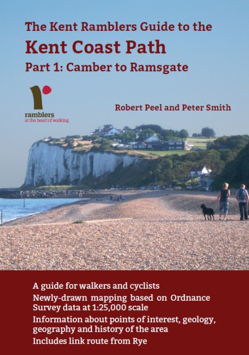
Guide to the
Kent Coast Path: Part 1, Camber to Ramsgate
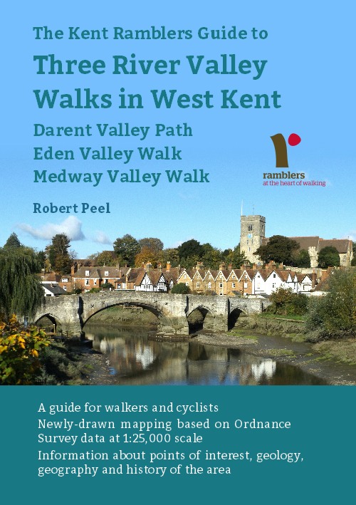
Guide to Three
River Valley Walks in West Kent: Darent Valley Path,
Eden Valley Walk and Medway Valley Walk
Ramblers' volunteers in Kent work tirelessly to
ensure that our paths are as well protected and
maintained as possible. Of course we also organise
led walks but most of our members are independent
walkers who simply want to support our footpath work.
Please
join us and become a supporter too. You need
us and we really need you.
Map contains Ordnance Survey data © Crown copyright
and database rights 2020. |