Cudham and Knockolt
Distance: 5.3 Miles (2.25 Hours)
OS Map: Explorer 147 (Start at grid
reference TQ446597)
Click map to enlarge and click
again to enlarge further
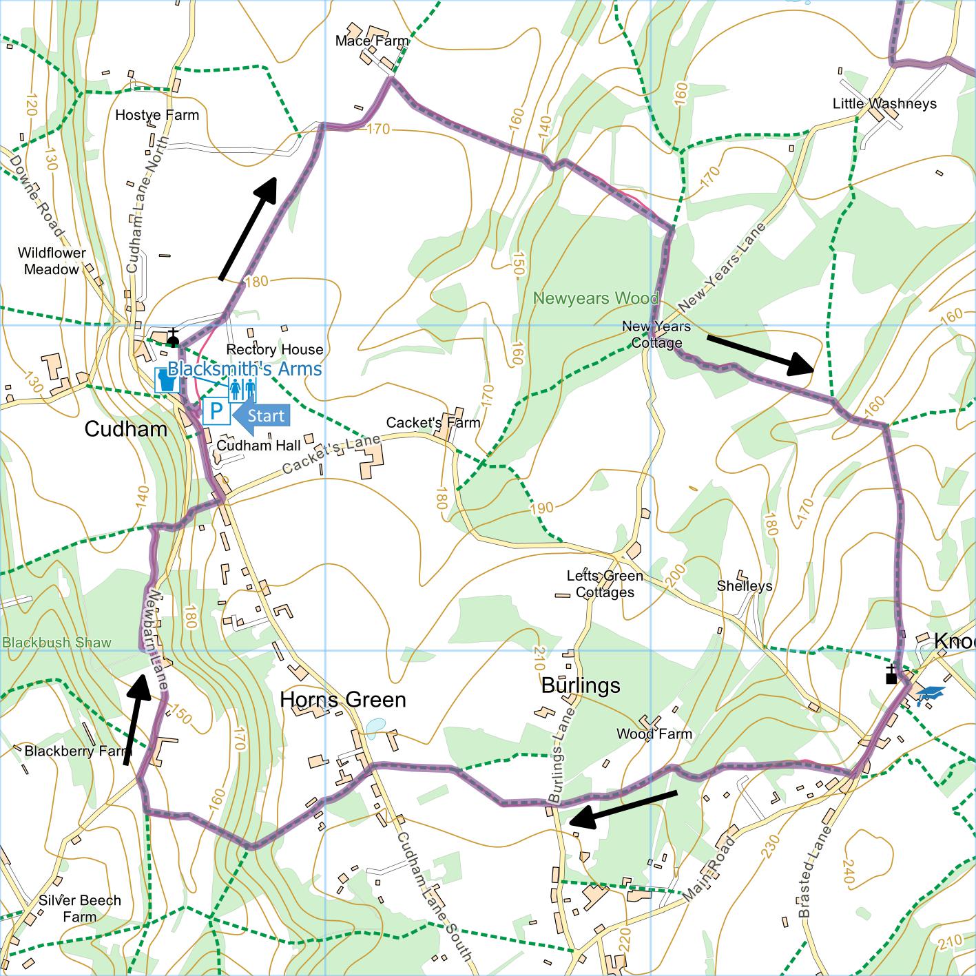
Park in free car park at Cudham recreation ground (on
left, just past Blacksmith’s Arms, when approaching from
Green Street Green).
Look for any notice indicating closing time,
which varies according to time of year.
Leave car park at north end on metalled path past tennis
courts. On
reaching churchyard, bear right along edge of recreation
ground to metal kissing gate.
Bear right across Rectory House driveway to
another kissing gate and follow right hand edge of field
to yet another kissing gate.
Cross next field bearing right to path between
hedges.
On reaching Mace Lane, turn right and, just before left
turn past row of houses, take footpath on right.
Follow path through narrow field then over a
couple of stiles into steep field – looking back on a
clear day you will see fine views of Canary Wharf.
Go straight down hill to bottom of valley and
over stile into wood.
Climb through wood and emerge into field.
Go straight uphill to protruding corner of field
bordered by oak trees.
From this point continue in same direction to far
right corner of field and climb stile by gate.
Take broad track through woods (chestnut coppice)
until you see New Years Lane on left.
Cross lane with New Years Cattery on your left and climb
over stile ahead. Follow
path through wood and then diagonally downward across
sloping field.
Climb stile onto path directly downhill between
fences.
Cross broad track along valley bottom and take path
opposite up right hand side of field.
About half way up, climb stile on right and go
through narrow band of woodland.
Cross large field diagonally to stile at highest
corner. From
here continue in more or less straight line, first along
left hand edge of fields then past Mitchell House, into
Knockholt churchyard just to right of church.
Emerge into Knockholt Main Road opposite the
school and turn right.
Continue past Shelleys Lane on right.
When you reach Brasted Lane on left, pavement
ends and you may need to cross to triangular piece of
grass on left.
At end of triangular grass, cross back to right
hand side of Main Road and, at bottom of driveway to
Windy Ridge, take path into field.
Cross top of field to far left hand (top) corner.
Take path in corner and follow path into woodland
with fence on left, eventually between fences.
Soon after end of fences, bear right downhill and
at bottom emerge from wood.
Turn left and follow edge of wood, climbing gently.
Follow waymarks over stiles to Burlings Lane.
Go straight across and take path along right hand
edge of field.
At corner bear right across field to stile in far
corner. Bear
left across next field to gate and stile in corner.
Cross Cudham Lane carefully.
Go up Thrift Lane opposite past various houses.
After Thrift Farm on right, path narrows and
leads into wood.
At junction of paths turn right downhill to
bottom of valley and then up other side.
Here the path is very narrow and overgrown
between fence and hedge on right but there is a broad
stony track running parallel on left that may offer a
preferable route to top of hill.
At gate and
T-junction with another path turn right and follow to
Newbarn Lane.
Turn right downhill.
Near lowest point of lane, go through gate on left
into Woodland Trust’s Blackbush Shaw. Bear right onto
track through trees and then along top of grassland. At
corner by information board turn right uphill to Newbarn
Lane. Cross carefully and climb steps on far side.
Soon emerge on Cudham Lane. Turn left and walk past
Cudham Hall back to car park.
|
Points of Interest
Cudham Hall
…
was until early 2001 a technical college run by the
Amalgamated Electrical and Engineering Union.
After the AEEU merged with the Manufacturing
Science and Finance Union the Hall was sold (in 2004)
and has now been converted to luxury apartments.
Blackthorn and Cherry Plum
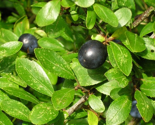
These hedgerow shrubs, which bear plentiful fruit in
late September and early October, are the parents from
which by multiple crosses all cultivated plums and the
damson have arisen. Blackthorn (pictured) is
also known as the sloe.
Public Transport
Service R10 connects Cudham recreation ground with
Orpington Station via Green Street Green.
In addition to the walking routes on our web site we
have published three popular walking guides:
Guide to Tunbridge
Wells Circular Walk and other walks in the area
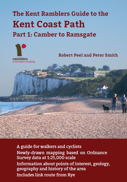
Guide to the
Kent Coast Path: Part 1, Camber to Ramsgate
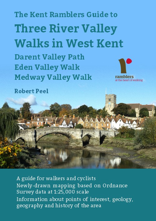
Guide to Three
River Valley Walks in West Kent: Darent Valley Path,
Eden Valley Walk and Medway Valley Walk
Please report any problems with this walk to
info@kentramblers.org.uk.
Ramblers' volunteers in Kent work tirelessly to
ensure that our paths are as well protected and
maintained as possible. Of course we also organise
led walks but most of our members are independent
walkers who simply want to support our footpath work.
Please
join us and become a supporter too. You need
us and we really need you.
Map contains Ordnance Survey data © Crown copyright
and database rights 2022. Some paths on map are based
on data provided by Kent County Council but do not
constitute legal evidence of the line of a right of way |