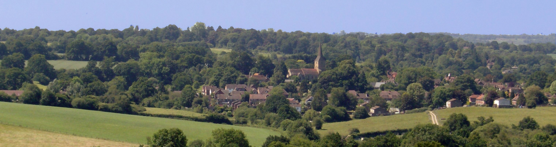
Hartfield and Bolebroke
Castle
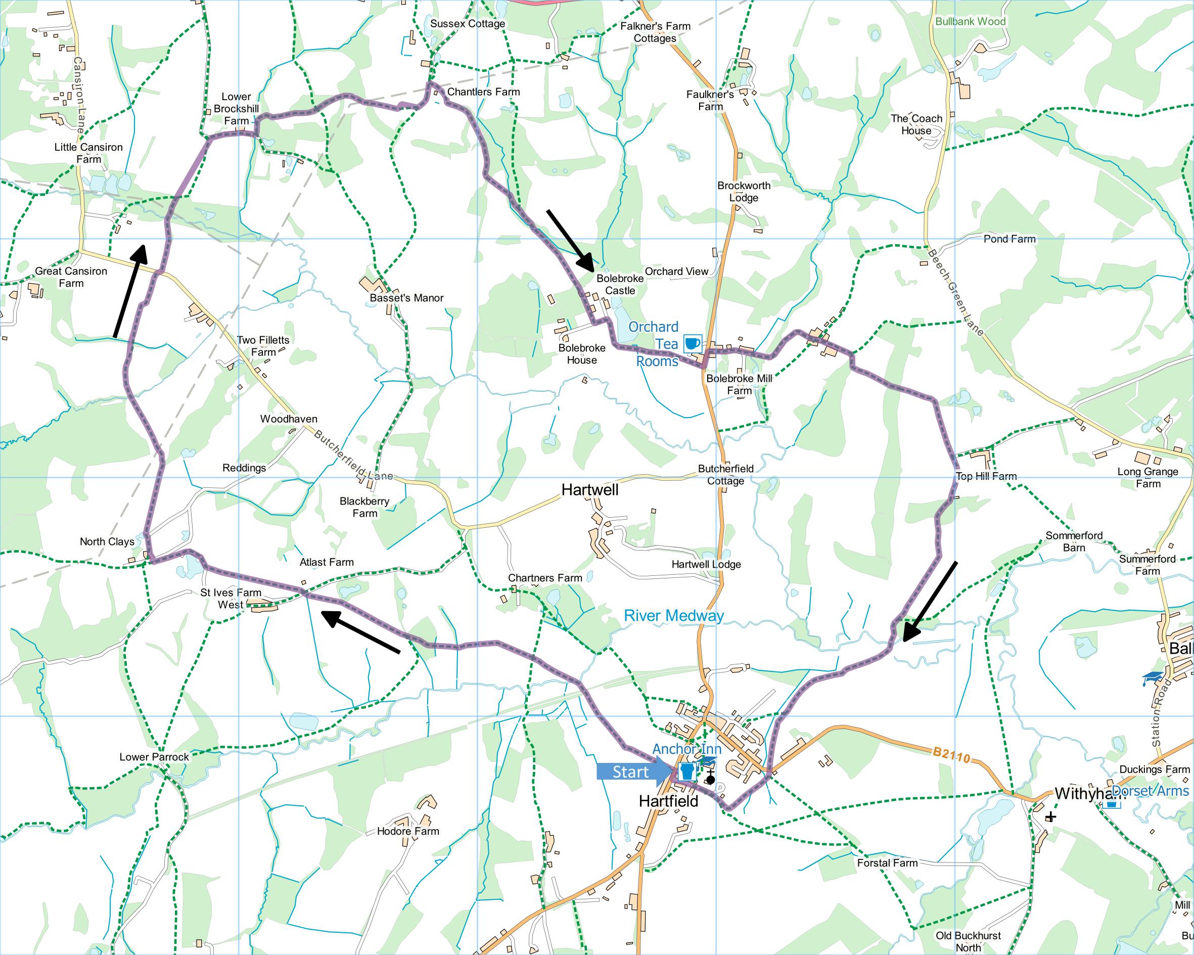
Distance: 6.9 Miles (3h 20m)
OS Map: Explorer 135 (Start at grid
reference TQ478358)
Click map to enlarge and click
again to enlarge further
Park in the High Street in Hartfield – there is
usually no problem parking near the sports ground
opposite the village hall.
Go through gate opposite village hall and take path
to left of tennis courts. Follow obvious route
until you reach Forest Way running along old railway
track. Go straight across, watching carefully for
cyclists, over stile and down to footbridge across the
Medway. On far side bear left diagonally across a
field to far side, cross bridleway and then another
field. Follow right hand side of next field, cross
another field and enter wood.
On emerging from wood over tile, cross next field
uphill diagonally to gateway and stile in hedge;
continue across next field to stile with gate above
leading to lane.
Take path opposite and bear left across large field
to camp site beside small lake. Keep lake on your
left and on far side find waymarked stile into field.
Follow right hand edge of field and half way along take
path through gate on right. Follow path along
track past North Clays farm and pond. When track
turns right, go through gate straight ahead. Bear
right and make for large tree in far right hand corner
of field – path may not be visible on the ground.
Go through gate by the tree and follow right hand edge
of field for 100 metres. Go through gateway in
hedge and follow left hand edge of next field for 100
metres. When the hedge bears sharp left, carry
straight on across the field to the bottom left hand
corner and through small pedestrian gate (if field is
cropped, instead follow left hand edge of field to
corner and down to gate).
Cross bridge over stream and on far side bear right
across the next field, first climbing gently and then
descending to cross ditch by waymarked post. On
far side of woodland, go uphill straight across a field
to emerge on a lane.
Take path over stile by gate on far side of lane just
a few yards to right. Head towards clump of trees
and down left hand side of trees to bottom corner of
field. Enter wood and cross footbridge.
Emerging from the wood, either take path straight up
field or, if this is not present, turn right along
bottom of field for a few tens of metres and turn left
up path when found (there should be a short waymarked
post). Emerge on lane at top.
Turn right down lane passing some houses. At
botton take path over stile by gate on left, soon
turning right uphill with woodland or thick hedges on
left and clearing on right. At top of clearing
take path into wood climbing steadily and bearing left
under power lines until you emerge onto path between
fences.
Go through gate at end and bear left to another gate,
cross field to third gate and turn left down sunken
track. Just past Chantlers Farm take footpath
through metal gate on right. Follow track bearing
right then left past some ponds then uphill across field
and into wood. On far side of wood, bear left
downhill to a gate into another wood. On the other
side follow a broad track along the valley bottom.
When the track bears right, go straight forward through
a gate and along a narrower track that takes you past
Bolebrook Castle.
At T-junction, turn left to main entrance to castle.
Turn right along drive all the way to main road.
Turn left along main road and take first turn on the
right past some houses. Follow track past houses,
keeping left at junction down to the valley bottom and
up other side. Just past pair of large oast houses
on right, go through a gap beside the gate and carry
straight on past very impressive old house. Follow
track downhill, bear right through gate and along bottom
of field. Turn left uphill along track between
fences and through narrow band of woodland to stile at
the far side. Bear right diagonally across field to
gate.
Through gate bear right through second gate and along
a path between fences. Pass with gates on left,
going forward on narrow path between a hedge on the left
and the fence of a paddock on the right, to enter wood.
On far side, head downhill along left hand edge of
field. Half way down bear right across field
towards gates at bottom. Pass gates and continue
downhill with wood (inside which there is a pond) on
left. In valley bottom, cross footbridge and go
through gate to Forest Way.
Watching carefully for cyclists, cross to far side
and climb stile into field. Bear right and cross a
large field diagonally. Go through gap and
continue to stile by gate. Follow bottom of field
to stile then bear left uphill to cross road at corner.
Take path opposite along right hand edge of field.
At corner over stile turn right uphill towards church
and join lane. Head downhill to High Street and
your car.
|
Points of Interest
Bolebroke Castle
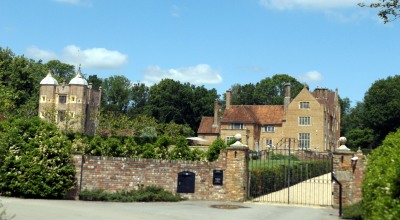
The "castle" was built as a hunting lodge around 1450
and is said to be the oldest brick building in Sussex.
Henry VIII supposedly stayed here while hunting in
Ashdown Forest and pursuing Anne Boleyn at nearby Hever
Castle. The house is no longer open to the public.
Orchard Tea Rooms
Open daily 9:30 to 4:30. For more details see their
web site.
Public Transport
There are buses from Tunbridge Wells and East
Grinstead – hourly on weekdays but rather less
frequently on Sundays.
In addition to the walking routes on our web site we
have published three popular walking guides:
Guide to Tunbridge
Wells Circular Walk and other walks in the area
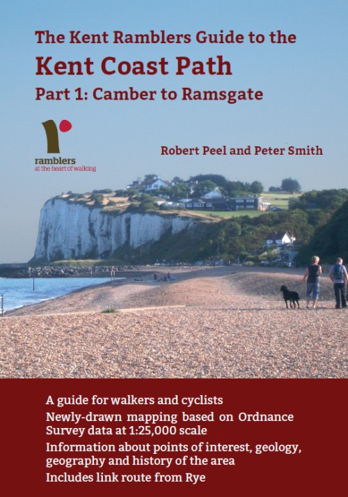
Guide to the
Kent Coast Path: Part 1, Camber to Ramsgate
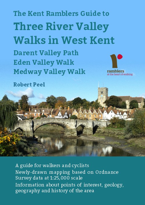
Guide to Three
River Valley Walks in West Kent: Darent Valley Path,
Eden Valley Walk and Medway Valley Walk
Please report any problems with this walk to
info@kentramblers.org.uk.
Ramblers' volunteers in Kent work tirelessly to
ensure that our paths are as well protected and
maintained as possible. Of course we also organise
led walks but most of our members are independent
walkers who simply want to support our footpath work.
Please
join us and become a supporter too. You need
us and we really need you.
Map contains Ordnance Survey data © Crown copyright
and database rights 2020. Some paths on map are based
on data provided by Kent County Council but do not
constitute legal evidence of the line of a right of way |