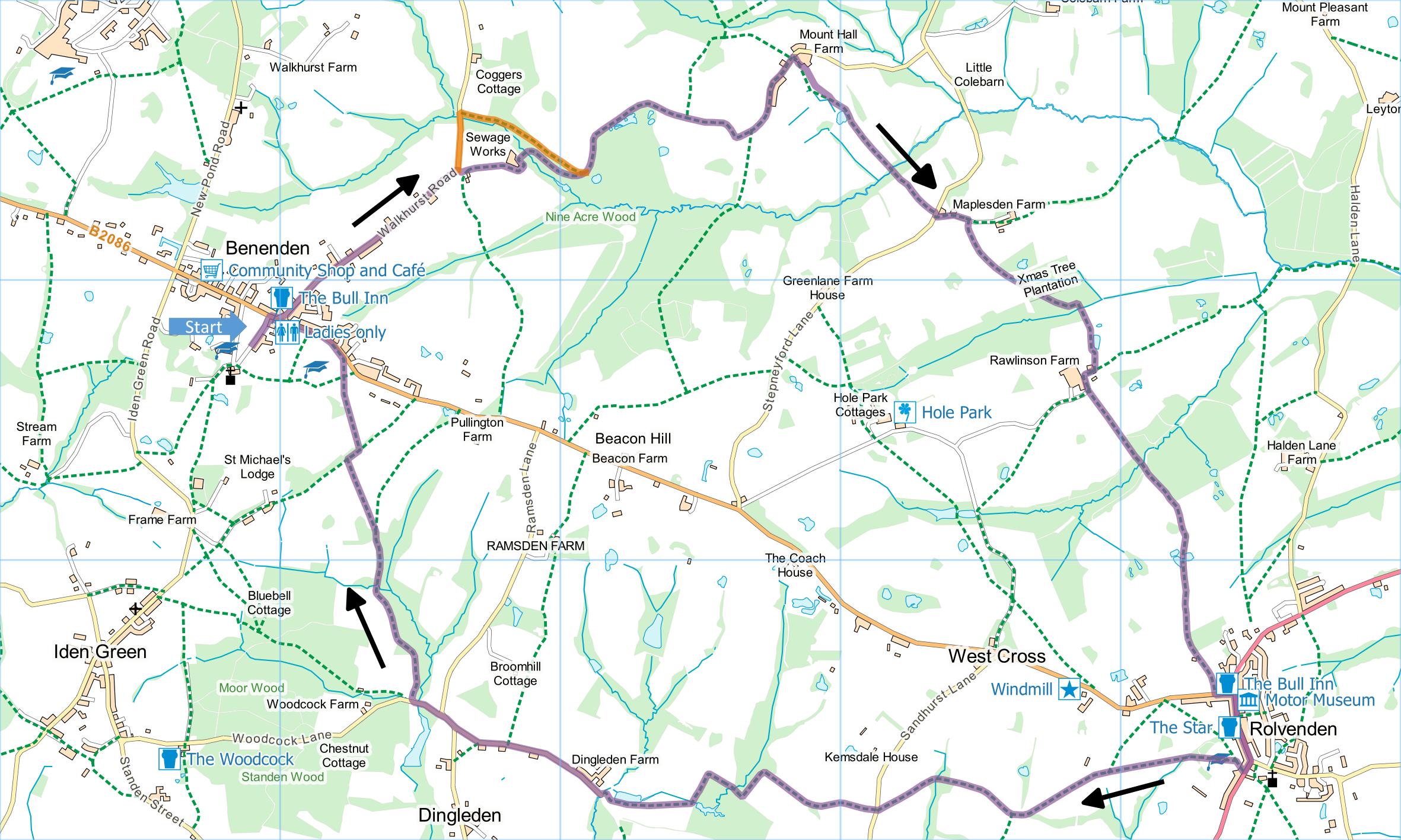
Benenden and Rolvenden
Distance: 7.5 Miles (3h 45m)
OS Map: Explorer 125 (Start at grid
reference TQ808328)
Click map to magnify and click
again to magnify further
Park around or near the village green in Benenden.
Go along main road past Bull Inn on right and turn
down Walkhurst Road. When after half a mile or so road
bends left, take footpath on right. [See Note 1.]
There are two footpaths – keep left of barn and head
downhill through gate along right hand side of remnants
of fence towards sewage works. Go round right hand
side and along back of sewage works, down to stream and
across footbridge. Bear right along path rising
gently through wood – there are pieces of yellow tape on
trees to mark the route. On joining broader track
at top of wood (see Note 1), turn right then follow the
track around left hand bend. At a junction, keep
right (path WC349). Continue through wood (with
ponds on your right) and then out of wood.
Follow track between hedges past cottages on right to
Mount Hall Farm. Take path on right just before
large barn. Cross scrubby area and enter field.
Follow left hand side between fences then cross next
field to jutting corner. Follow hedge on right, go
through gate, pass pond on right and aim for gateway in
middle of bottom edge of field. Cross middle of
field to well-hidden footbridge in ghyll at bottom.
On other side go over stile and climb along left hand
edge of field with superb views of Weald looking back.
At lane bear right then left up concrete farm track
opposite, past cottages on left and through wooden
gates. Take track on right (WC347) just before
converted oast houses, soon bearing left through
orchard. On entering open field path should go
diagonally left across field but is often cropped, in
which case it may be easier to turn left along top edge
of field then go right downhill at corner.
Immediately past section of woodland on left, go left
through gap to Christmas tree plantation. The path
should go diagonally across the field but the tree
planting may have obstructed the correct route, in which
case go down right hand side of plantation then along
the bottom for 100 metres to stile. Over stile
head downhill through short section of woodland, bearing
left to cross two footbridges over stream in ghyll.
Through gate, follow right hand then left hand edge of
field towards oast house then through gates to pass just
to left of oast onto farm track. Turn right into
farmyard then left on track, enter field at corner and
go straight across towards woodland. At corner of
field enter woodland through kissing gate, descend into
ghyll, cross footbridge and climb up through another
kissing gate. Follow left hand edge of field (with
more classic Wealden views looking back) then along
track into Rolvenden.
There are seats for lunching on the village green on
right. Turn left past pub then right along main
street towards church. Bear right at church then
take path on right just before the village school.
Bear left across playing field. Go through section
of woodland into field and bear left across field to
gate. Cross narrow field to footbridge and stile.
Cross next field diagonally to far corner then follow
left hand edges of a couple of fields into woodland.
On far side, bear left across field to lane.
Across lane follow path along left hand edges of
field and then orchard to corner. Through gap into
next orchard follow right hand edge and bear left at
corner. At next corner go right through section of
woodland and into field. Follow fence on left to
protruding corner then bear left to bottom corner.
Go through gate and turn left along bottom of field.
Follow round left hand edge of pond to lane.
Turn right along lane passing junctions on both left
and right (bear right then left). Just after
crossing stream by short strip of woodland take path on
right following clear waymarks alongside and through
woodland. Cross stream in Strawberry Wood over an
ancient and recently excavated culvert then climb
through wood into open field. Bear left to top
corner of field and go through gate onto track.
Turn right but soon take path on left diagonally across
corner of field to gate. Continue in same
direction diagonally across another field to scrubby
area. Bear right to road and turn left back to
Benenden village green; alternatively keep left passing
to left of school, follow left hand side of two fields
to church and return to green through churchyard.
Note 1. At the time of writing the step is
missing from the stile leading from Walkhurst Lane to
the footpath. If this remains the case and makes
the stile too difficult to use, continue down Walkhurst
Lane and, just past lowest point where lane crosses
stream, take footpath on right through woods becoming
the “broader track” mentioned in the directions.
In due course follow this round left hand bend and
continue according to the directions above. The
alternative route is shown in orange on the map.
|
Points of Interest
Rolvenden Windmill
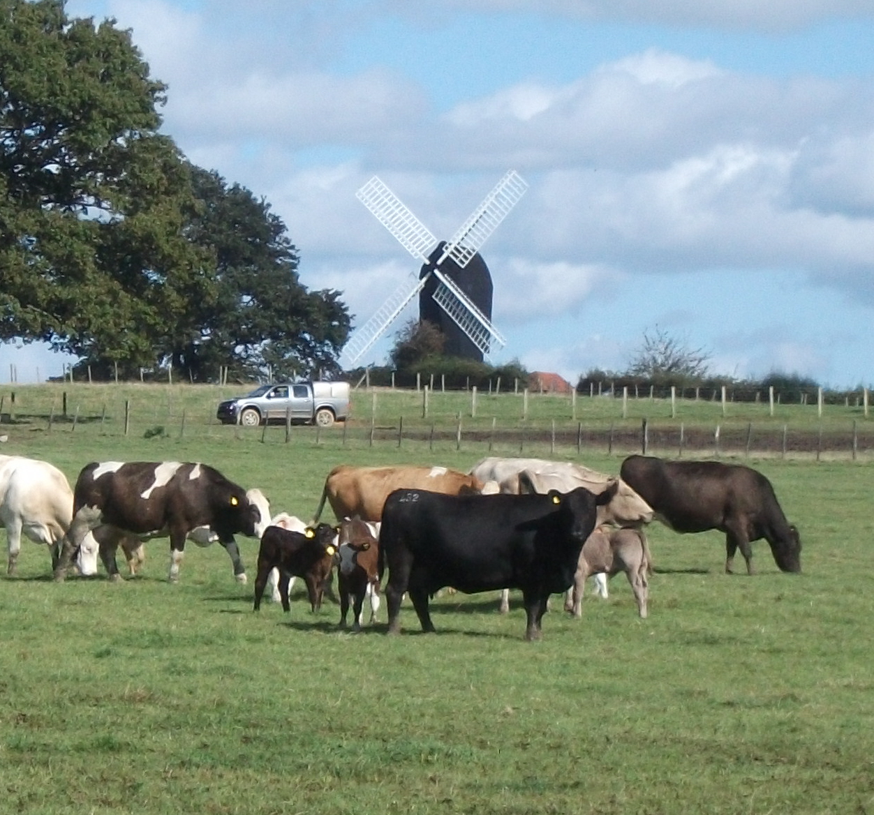
The mill, seen early on the return leg from
Rolvenden, could have been built as early as 1580. It is
a post mill - the whole building rotates on a post
embedded in a brick roundhouse to achieve optimal
orientation with the wind. The mill was last used around
1885 and restored in 1956.
Strawberry Wood
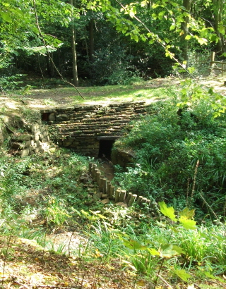
In the wood your route crosses an old stone culvert.
This has recently been restored but its age remains a
mystery. It was certainly built to allow heavy
loads to cross, which could suggest a connection with
the Wealden iron industry in Tudor and early Stuart
times (see Kent Ramblers Annual Review 2013 for more
details). However it could be much older, perhaps
dating to Roman times.
Public Transport
There are buses from Tunbridge Wells to Benenden and
Rolvenden.
In addition to the walking routes on our web site we
have published three popular walking guides:
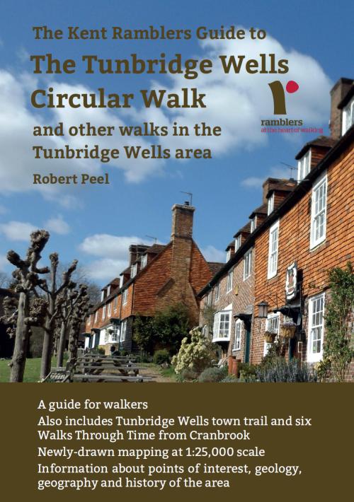
Guide to Tunbridge
Wells Circular Walk and other walks in the area
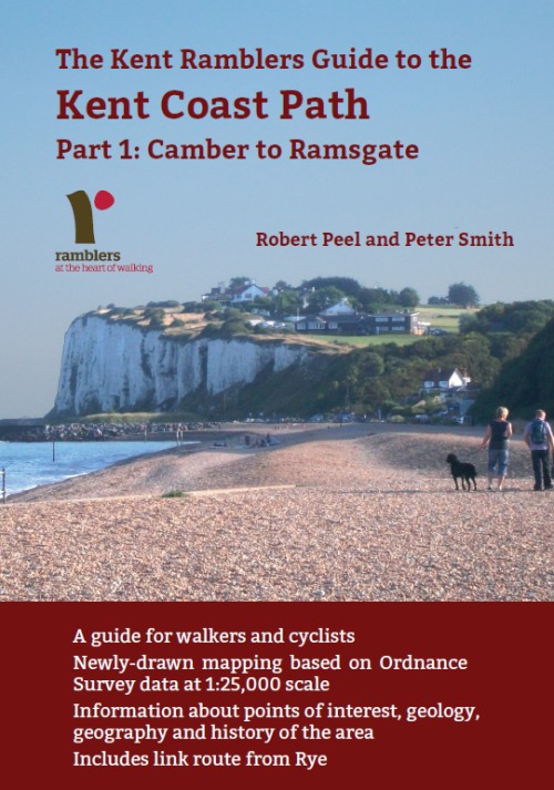
Guide to the
Kent Coast Path: Part 1, Camber to Ramsgate
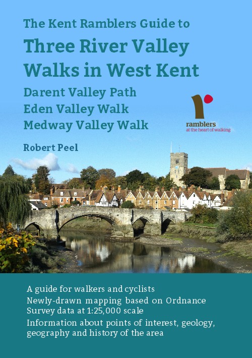
Guide to Three
River Valley Walks in West Kent: Darent Valley Path,
Eden Valley Walk and Medway Valley Walk
Please report any problems with this walk to
info@kentramblers.org.uk.
Ramblers' volunteers in Kent work tirelessly to
ensure that our paths are as well protected and
maintained as possible. Of course we also organise
led walks but most of our members are independent
walkers who simply want to support our footpath work.
Please
join us and become a supporter too. You need
us and we really need you.
Map contains Ordnance Survey data © Crown copyright
and database rights 2020. Some paths on map are based
on data provided by Kent County Council but do not
constitute legal evidence of the line of a right of way |